JOSEPH CITY
ArizonaHISTORY
Joseph City was one of four Little Colorado River colonies founded in 1876 by the Church of Jesus Christ of Latter-day Saints. The other river colonies, though no longer present, were Brigham City, Sunset, and Obed. The town was named to honor Joseph Smith, founder of the Latter Day Saint movement.
The Navajo People and Latter Day Saints shared a most unusual bond. As the story goes, “A heavenly messenger gave the Book of Mormon to Joseph Smith, in the form of golden plates. Over the following 2 years, the plates were translated into English, published as scripture and a companion to the bible. The book represented the history of the ancestors of the Native Americans. It contained the record of Christ coming to this land after he left Jerusalem. After gaining possession of this record and knowledge of its contents,” the Mormons began to regard “the Navajo as their brothers.”
- David K Flake 1965
1 (Hover to reveal outline)
LOCATIONS
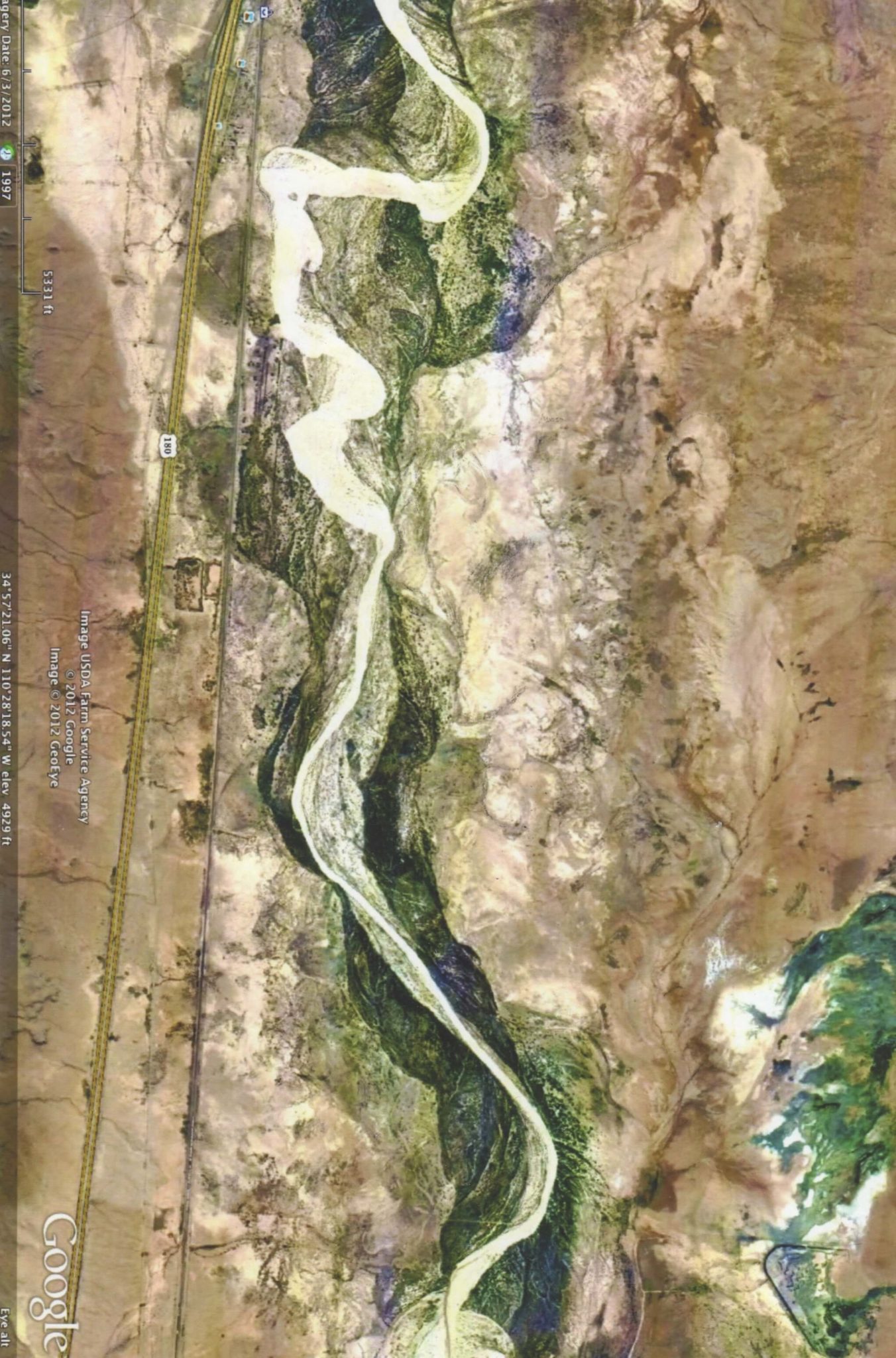
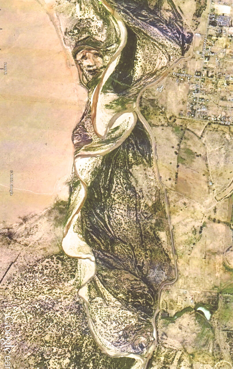
Just a few miles below Joseph City, lying next to the Colorado River, is the detailed face of a man measuring 3 miles by 1 mile in size. This landscape image could well be a portrait of Joseph Smith himself, surrounded by the Colorado River and the desert.
2: Homolovi Ruins
HOMOLOVI
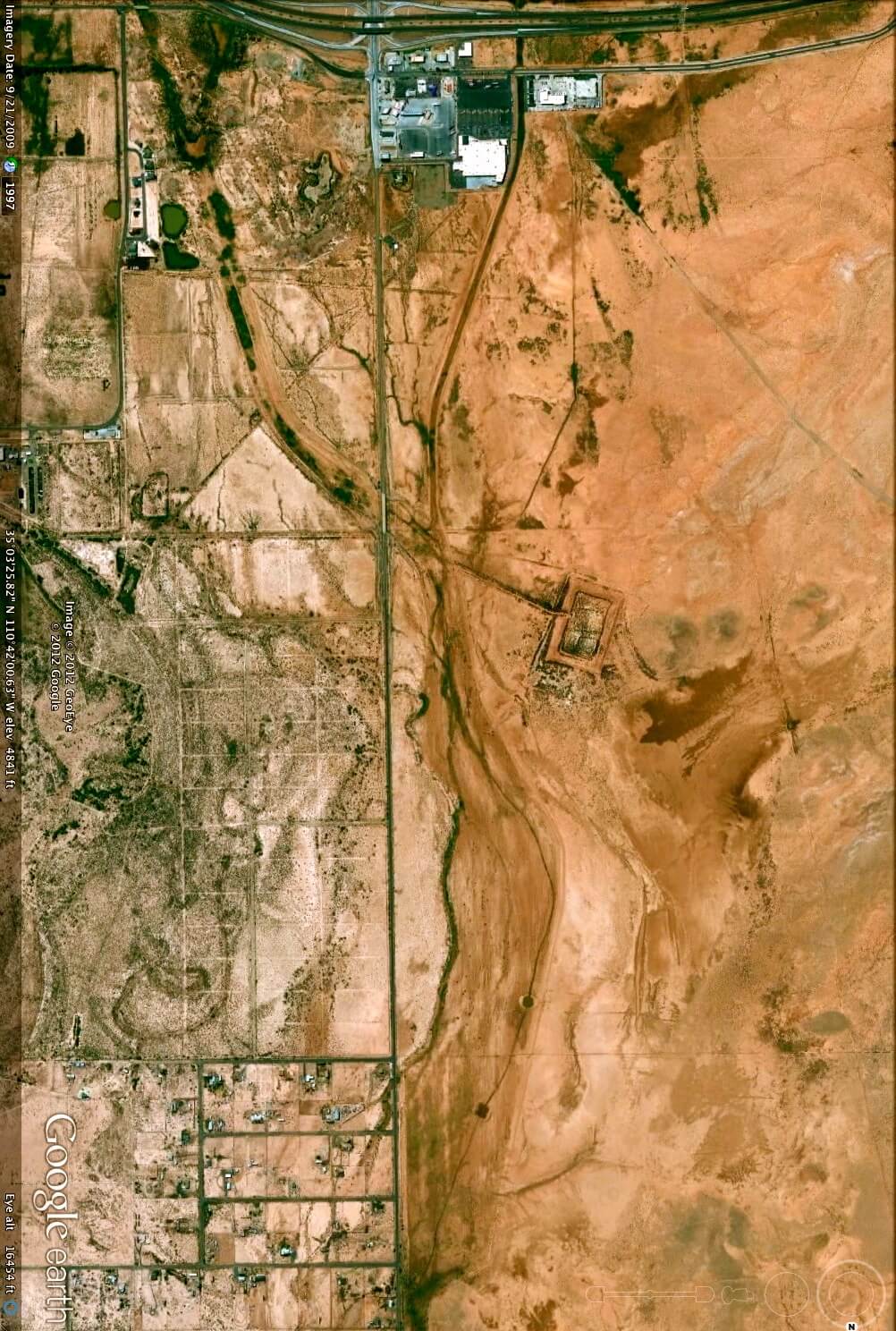
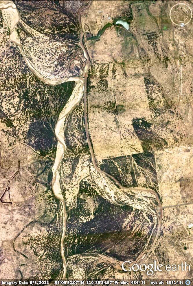
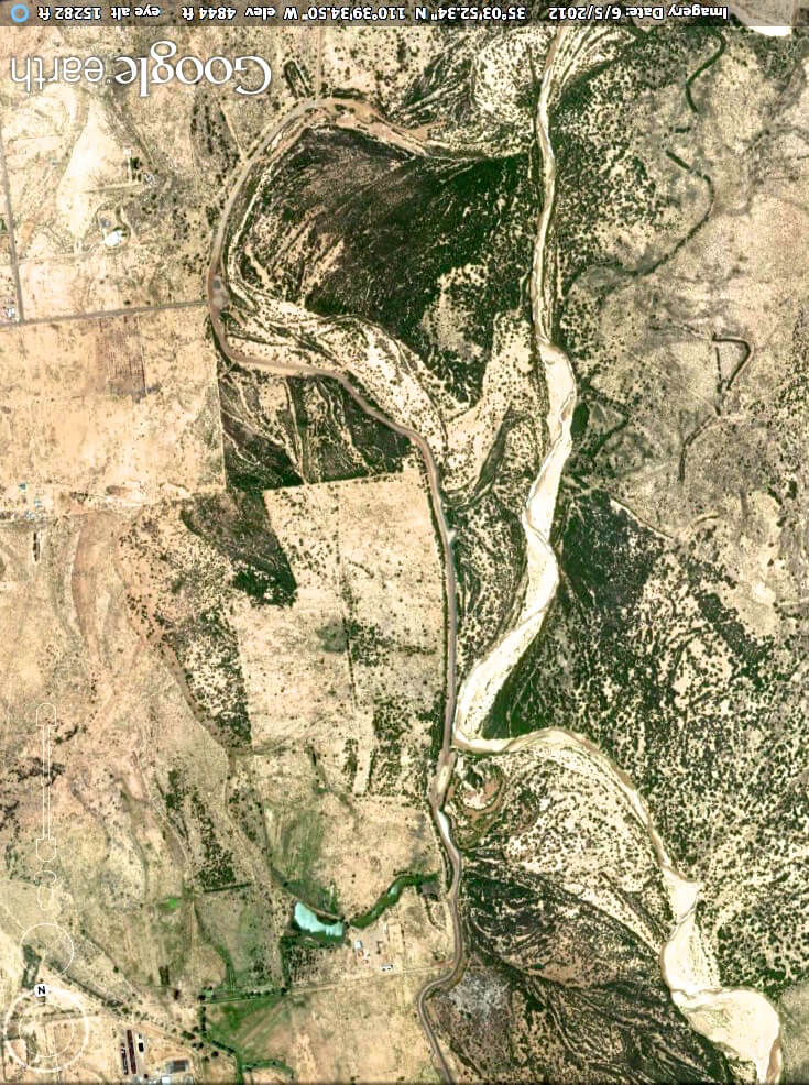
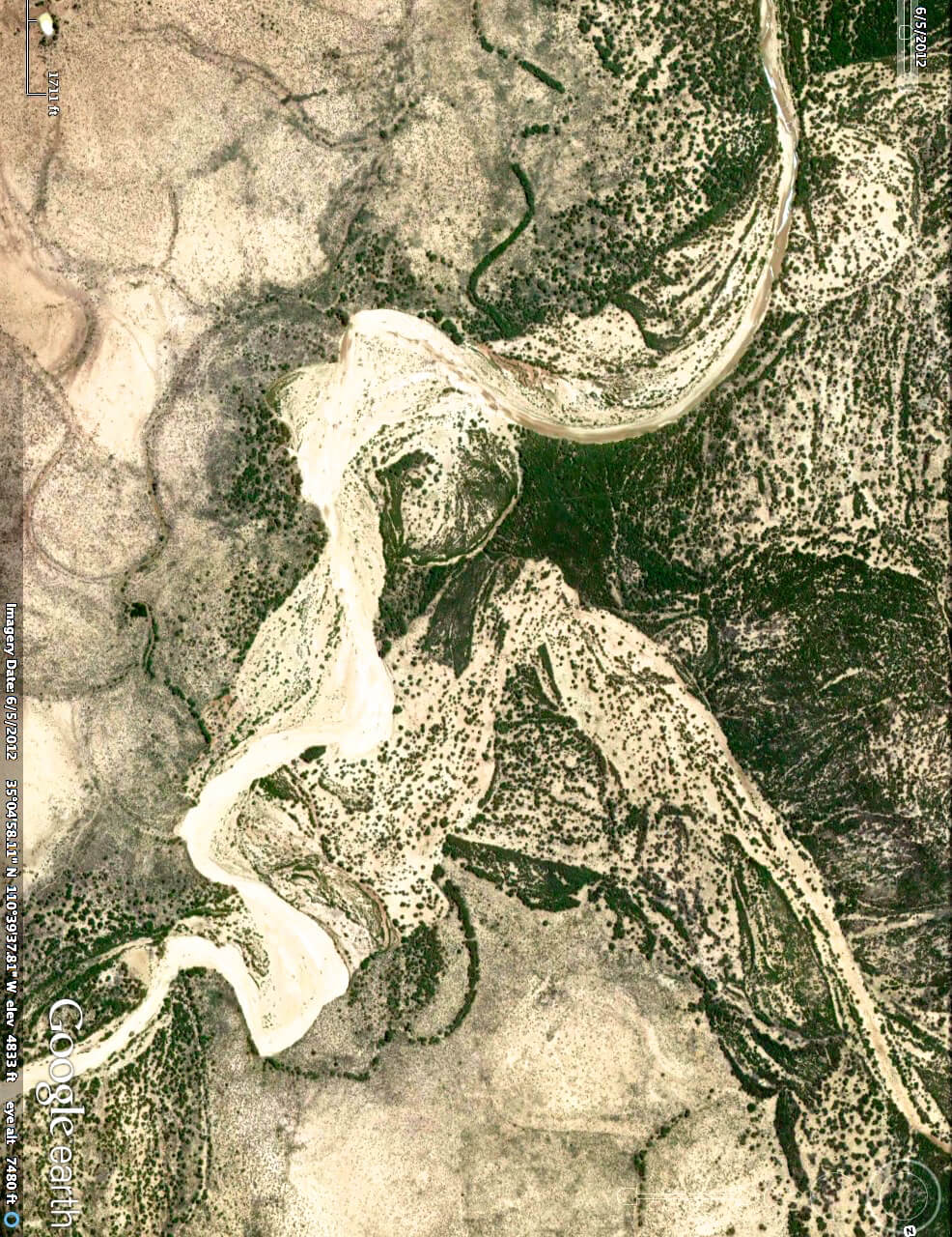
Continuing along the Colorado River and main highway just 12 miles below the face, the river takes a sharp turn flowing through the Homolovi Pueblo. The state calls this area the Homolovi Ruins, but the Hopi call it Homolovi Pueblo, the living land of their ancestral spirits. It is here, along this 4.5-mile section of the Colorado, that three very detailed river guardians come into view.
3: Overview of Homolovi
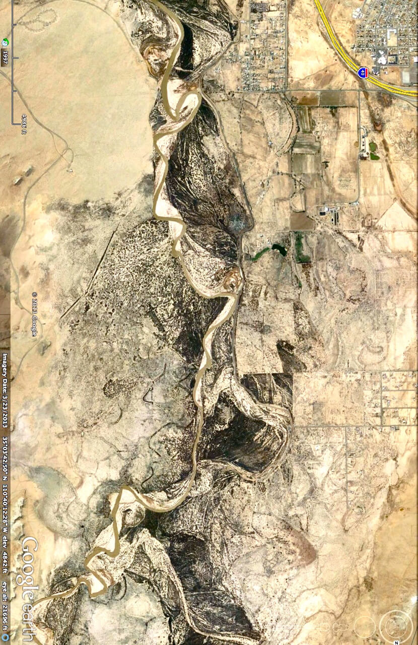
4: Colorado River (Click to enlarge and see all 3 beings in the river)
5: The Emissary (Click to enlarge)
The first guardian is the smiling, long-robed Emissary or 'welcoming committee.' Second, and just below him, holding the tail end of the emissary's robe, is a Priest. The priest's upraised arm channels the river that flows down his body and over the folds of his priestly garment. This priest however holds an unusual secret. When his image is turned-upside down, the Priest becomes a prayerful, Penitent Man. This rare dual image is known as an ambigram, an art form or other symbolic representation, whose elements retain meaning even when viewed or interpreted from a different direction.
6: Priest of Homolovi (Hover to reveal outline)
7: Penitent Man (Hover to reveal outline)
The third guardian reveals a child kneeling at the river with her face partially veiled. Her tiny hands hold the face of a Cuckoo bird-a symbol of meditation and rebirth. Details reveal her sandaled feet, tiny fingers and a cuckoo bird resting with wings unfolded wings. Interestingly, the cuckoo bird is known around the world, as the bird associated with meditation.
8: Child With Cuckoo Bird (Hover to reveal outline)

9: Southwest Cuckoo Bird
HOPI
Homolovi is Hopi for 'Place of the Little Hills' - the traditional name for Winslow, Arizona. It lies just south of Joseph City. In the high grassland of 14th century northern Arizona, an ancient people found a home along the Little Colorado River. These people, the Hisat'sinom (known to archaeologists as the Anasazi), paused in their migrations to till the rich flood plain and sandy slopes before continuing north to join people already living on the mesas, people who are today known as the Hopi. The Hopi people of today still consider Homolovi, to be part of their homeland. They continue to make pilgrimages to these sites, renewing the ties of the people with the land. Migrations to Homolovi ended when the people finally settled at the center of the world, the Hopi Mesas north of Homolovi.
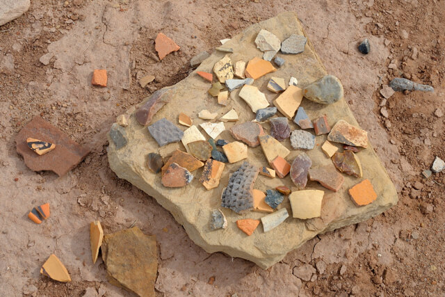
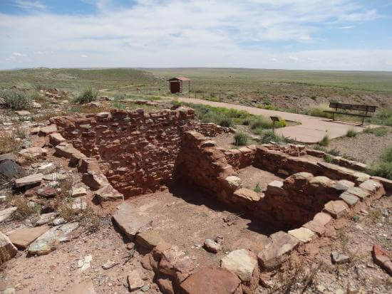
10: Pottery Shards
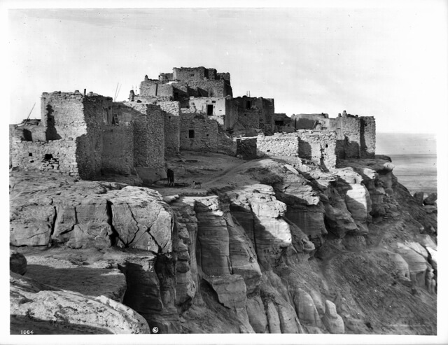
11: Hopi Pueblo
HOW TO LOCATE THE LANDSCAPE
Finding landscapes is a matter of patiently searching small areas of your map at varyingly levels of altitude. Some landscapes are only 500 feet in length while others are a phenomenal 2,000 miles in length. The larger the landscape the farther away you have to be to see it. Check places that you have always liked to go, as familiarity can help. Bear in mind that not all landscapes are found right side up!
DIRECTIONS FOR FINDING Joseph City
- Using Google earth to find Joseph, go to Coordinates 34°57’14.66″N by 110°40′20.50”W.
- Set compass so that North points West. *Eye altitude is 29,692 feet
- Satellites: This image date is no longer available. Present day image is best available.
DIRECTIONS FOR FINDING Homolovi
- Using Google earth to find Homolovi, go to Coordinates 35°03’41.86″N by 110°28′04.62”W.
- Set compass so that North points South. *Eye altitude is 18,249 feet
- River imagery covers 4.5 miles of the Colorado River
*Satellite date: 2016 Google
- Goggle Earth
- homolovi-ruin; State Park website
- Google Earth
- Google Earth
- Google Earth
- Google Earth
- Google Earth
- Google Earth
- bigstockphoto-218448019
- pottery_chards: bigstockphoto
- Wikimedia Commons: File: Hopi Indian pueblo of Walapi (or Walpai) on mesa, ca.1901 (CHS-1064).jpg File:Hopi Indian pueblo of Walapi (or Walpai) on mesa, ca.1901 (CHS1064).jpghttp://digitallibrary.usc.edu/cdm/ref/collection/p15799coll65/id/15466 Photo by Charles C Pierce-1861-1946