SOUTHERN COSO PAIUTE of the SKY BLUE HILLS
West Panoche Hills, Southern California
INTRODUCTION
“There is only one place in the entire world named Panoche, making it unique among the world’s place names.” National Geographic
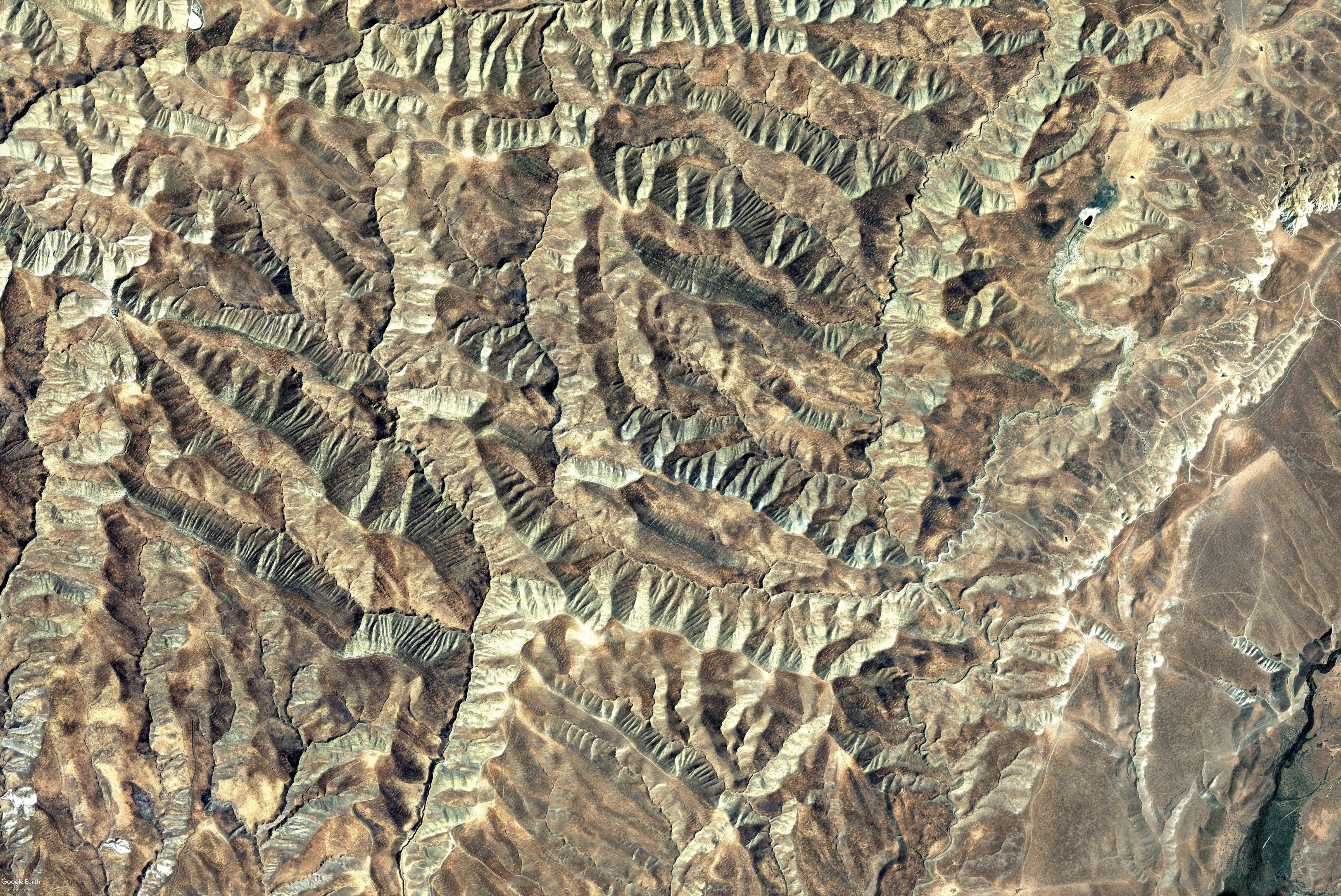
 This extraordinarily beautiful wilderness of razor contoured ridges, thrusting deep canyons and windswept plateau’s, are surrounded by the Panoche Valley, Panoche Hills and Little Panoche.
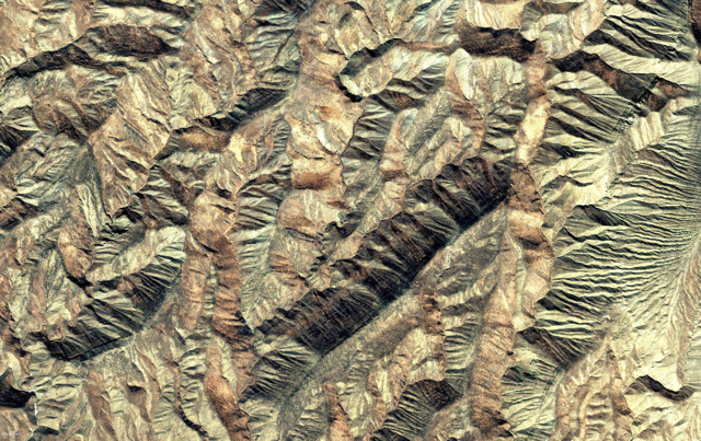
It is here, amongst all this raw beauty that this lovely face was discovered, enclosed by two ridges of crystal-blue quartzite and pink granite. The face’s beauty, clarity and perfect proportion are simply astonishing, considering that this sculpture is 1,927 feet in length.
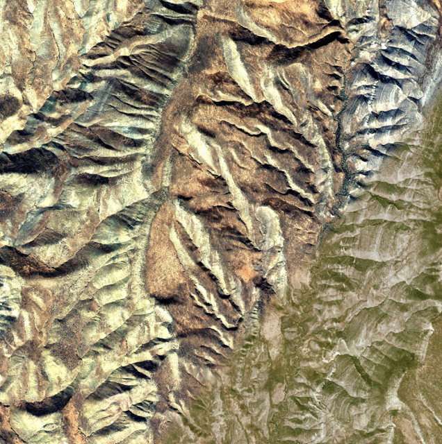
In the Southeast Panoche we discovered yet another face. This one is of a Coso Paiute Elder whose face is well over 4500 feet long. His face seems deep in thought, as he looks into the distance to the life saving waters of the Panoche Creek. His coordinates are 37°29’31.53 N by 114°15’22.45 W.
The Panoche Creek watershed is one of the largest on the east side of the Diablo Range that flows close to year-round, making the watershed’s riparian woodlands and wetlands an irreplaceable habitat.
THE PEOPLE
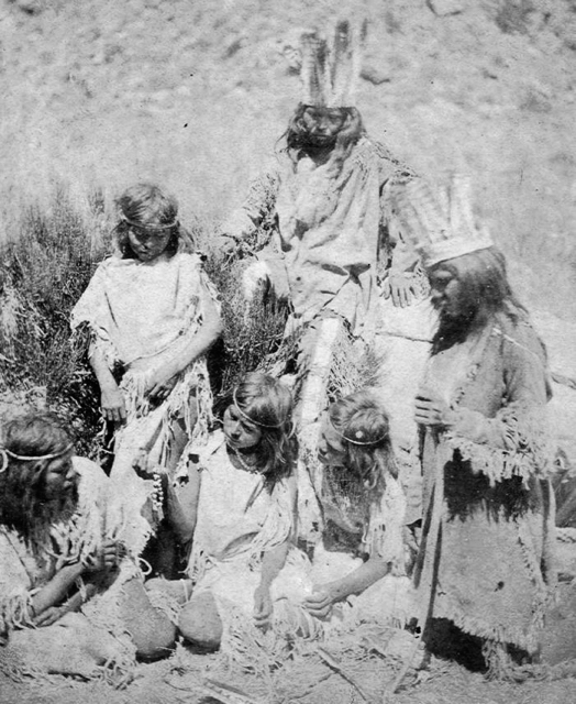 “It is the Southern Coso Paiute who occupied this southeastern portion of California. They were known for possessing many good qualities like being moral and peaceful.
In fact, what they are known for is their non-violent ways [which seems evident in the peaceful face of this Coso landscape]. The Coso strongly believe in ‘Puha’ or power, a traditional belief that everything in the universe has a life force. The Paiute practice meditation and perform special rituals in an attempt to harness the puha.” http://native-american-indian-facts.com/Great-Basin-American-Indian-Facts/Paiute-Indian-Tribe-Facts.shtml
 Coso Paiute legends say that they emerged from the mud of local Coso Hot Springs at China Lake, Ridgecrest, CA. Both Coso Hot Springs and the vast Coso Rock Art fields, containing over 50,000 documented petroglyphs, are both located within the boundaries of the Naval Air Weapons Station at China Lake. Personnel of the base believe that the petroglyphs, located within the installation, are a “treasure” and should be shared with the general public.
GEOGRAPHY
“The Panoche Valley is a unique California treasure – and one that should be protected. Located 30 miles south of Los Banos and 60 miles west of Fresno, the Panoche Valley represents a lost landscape in California’s busy and fragmented Central Valley and surrounding foothills – a pastoral valley of open grass lands. This area is a landscape lush with a diversity of wildlife found nowhere else.”
Kim Defino: Defenders of Wildlife
Mercey Hot Springs, lying less than 2 miles southwest of this sculpture, could be considered, like Coso Hot Springs, to be a similar place of emergence. Mercey Hot Springs runs along the powerful San Andreas Rift Zone at an elevation of 1161 feet.
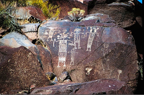
PETROGLYPHS
The Southern Coso Paiute are also known for creating the largest and best preserved repository of rock art ever found in North America.


The Rock Art fields and Coso Hot Springs, CA, are located on the US Naval Base.
FOSSILS and ROCKS
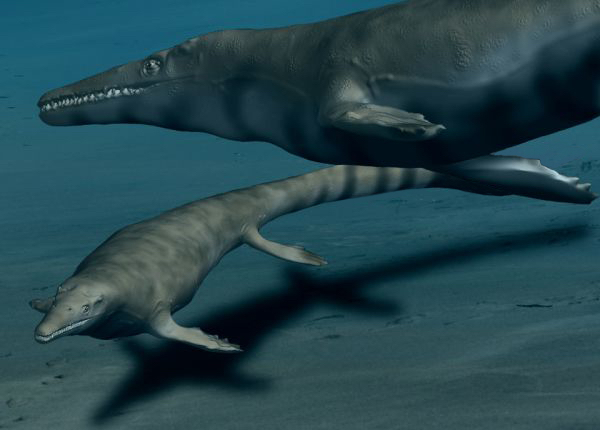 The Panoche Hills hold the remains of an ancient inland sea, 65 million years old, when most of California was under water. As the seas withdrew, the bottom of this inland sea revealed the bones of many ocean creatures such as turtles, smaller dinosaurs, fish and seashells. Teeth from a marine predatory dinosaur called a Mosasaur were found in the Panoche Hills west of Chowchilla. The entire Panoche area is noted for its fossil records, both vertebrate and invertebrate.
 The landscape is strewn with crystals and rocks of all manner. Blue quartzite minerals like chrysolite, pink granite, hematite, iron pyrite, jade, manganese jasper, agate, chert and other semi-precious quartz rock can be found right on the surface. It also held one of the largest repositories of quicksilver ever found and is a “rock-hounds paradise.”
ENDANGERED SPECIES
 “Panoche Valley grasslands are a sanctuary for all manner of rare birds like the Golden Eagle, both the Merlin and Prairie Falcons, the Burrowing Owl and many more. The valley’s habitat provides protection for these endangered birds and for mammals like the Kit Fox, Antelope Squirrel and American Badger.” Wikipedia.org
TODAY
Over the years, mining companies have taken over parts of these landscapes and depleted the blue calcite and pink granite that once surrounded this Coso Paiute face. One of the richest quicksilver mines ever found, now lies empty in the Panoche. As with many of our wide-open prairie lands, they are being sought out for fraking, drilling, and building vast solar farms, with little regard for the endangered species whose very survival depend on the open prairies.
HOW TO LOCATE THE LANDSCAPE
Finding landscapes is a matter of patiently searching small areas of your map at varyingly levels of altitude. Some landscapes are only 500 feet in length while others are a phenomenal 2,000 miles in length. The larger the landscape the farther away you have to be to see it. Check places that you have always liked to go, as familiarity can help you see the unseen. There is one more consideration, not all landscapes are found right side up!
DIRECTIONS FOR FINDING: COSO PAIUTE
TREASURE HUNT MAP
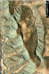
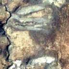 The face of this young Paiute child is hidden in these hills. Can you find him?
Roam the Panoche Hills and see if you can find the little Coso boy. Enlarging the map will help in your search.